
La Grange de Cellet topographic map
Interactive map
Click on the map to display elevation.
About this map
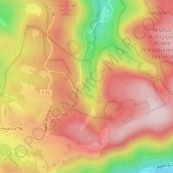
Name: La Grange de Cellet topographic map, elevation, terrain.
Average elevation: 840 m
Minimum elevation: 623 m
Maximum elevation: 965 m
Other topographic maps
Click on a map to view its topography, its elevation and its terrain.
Le Haut du Tôt
France > Grand Est > Vosges > Sapois
Le Haut du Tôt, Sapois, Saint-Dié-des-Vosges, Vosges, Grand Est, France métropolitaine, 88120, France
Average elevation: 746 m