
旁辛乡 topographic map
Interactive map
Click on the map to display elevation.
About this map
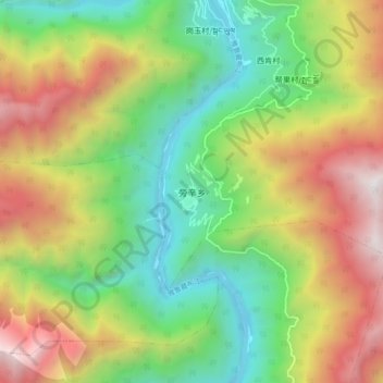
Name: 旁辛乡 topographic map, elevation, terrain.
Location: 旁辛乡, 帮辛乡, 墨脱县, 林芝市, 西藏自治区, 中国 (29.54610 95.34190 29.62610 95.42190)
Average elevation: 1,904 m
Minimum elevation: 843 m
Maximum elevation: 3,444 m