Geolocate

Coleman topographic map

Interactive map

Click on the map to display elevation.

About this map

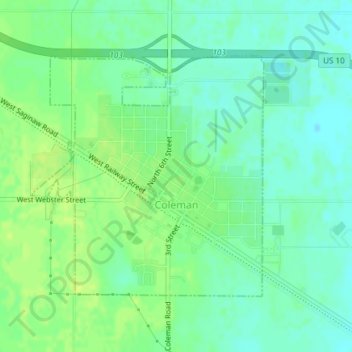
Name: Coleman topographic map, elevation, terrain.

Location: Coleman, Midland County, Michigan, United States (43.74965 -84.60122 43.76811 -84.57654)

Average elevation: 231 m

Minimum elevation: 223 m

Maximum elevation: 238 m

Other topographic maps

Click on a map to view its topography, its elevation and its terrain.

Hope

United States > Michigan > Midland County

Hope, Hope Township, Midland County, Michigan, 48628, United States

Average elevation: 205 m

Warren Township

United States > Michigan > Midland County

Warren Township, Midland County, Michigan, 48618, United States

Average elevation: 223 m

Mills Township

United States > Michigan > Midland County

Mills Township, Midland County, Michigan, United States

Average elevation: 207 m

Midland

United States > Michigan > Midland County

Midland, Midland County, Michigan, United States

Average elevation: 194 m

Greendale Township

United States > Michigan > Midland County

Greendale Township, Midland County, Michigan, United States

Average elevation: 208 m

Midland Township

United States > Michigan > Midland County

Midland Township, Midland County, Michigan, United States

Average elevation: 191 m