
Cumanda topographic map
Interactive map
Click on the map to display elevation.
About this map
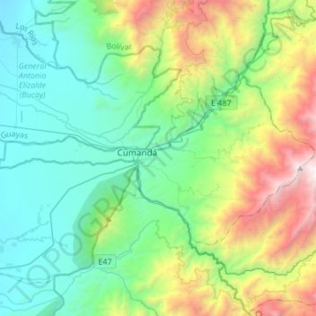
Name: Cumanda topographic map, elevation, terrain.
Location: Cumanda, Chimborazo, Ecuador (-2.28399 -79.25441 -2.13772 -78.98411)
Average elevation: 1,026 m
Minimum elevation: 99 m
Maximum elevation: 3,461 m