
Thank you for supporting this site ❤️
Make a donation
Make a donation
Ramalhal topographic map
Click on the map to display elevation.
Thank you for supporting this site ❤️
Make a donation
Make a donation
About this map
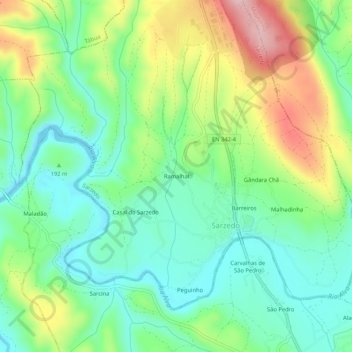
Name: Ramalhal topographic map, elevation, terrain.
Location: Ramalhal, Sarzedo, Arganil, Coimbra, 3304-909, Portugal (40.22614 -8.09803 40.26614 -8.05803)
Average elevation: 195 m
Minimum elevation: 122 m
Maximum elevation: 333 m
Thank you for supporting this site ❤️
Make a donation
Make a donation