
Wollongong City Council topographic map
Interactive map
Click on the map to display elevation.
About this map
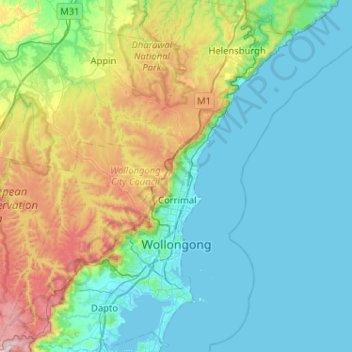
Name: Wollongong City Council topographic map, elevation, terrain.
Location: Wollongong City Council, New South Wales, Australia (-34.55374 150.63510 -34.13002 151.06658)
Average elevation: 156 m
Minimum elevation: -1 m
Maximum elevation: 725 m
Other topographic maps
Click on a map to view its topography, its elevation and its terrain.