
Iparía topographic map
Interactive map
Click on the map to display elevation.
About this map
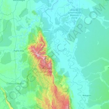
Name: Iparía topographic map, elevation, terrain.
Location: Iparía, Coronel Portillo, Ucayali, Perú (-10.09385 -74.67809 -8.77613 -73.06659)
Average elevation: 330 m
Minimum elevation: 142 m
Maximum elevation: 2,370 m