
Thank you for supporting this site ❤️
Make a donation
Make a donation
Teesa topographic map
Click on the map to display elevation.
Thank you for supporting this site ❤️
Make a donation
Make a donation
About this map
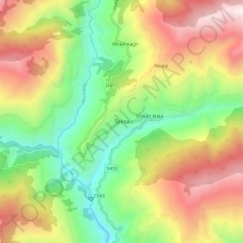
Name: Teesa topographic map, elevation, terrain.
Location: Teesa, Chaurah, Chamba, Himachal Pradesh, 176316, India (32.79222 76.11383 32.87222 76.19383)
Average elevation: 1,872 m
Minimum elevation: 1,053 m
Maximum elevation: 2,924 m
Thank you for supporting this site ❤️
Make a donation
Make a donation