
Thank you for supporting this site ❤️
Make a donation
Make a donation
Oreshek topographic map
Click on the map to display elevation.
Thank you for supporting this site ❤️
Make a donation
Make a donation
About this map
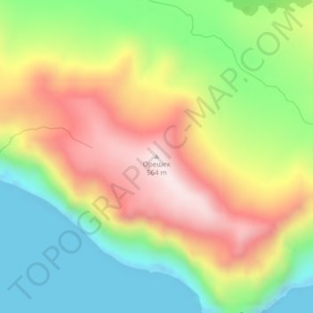
Name: Oreshek topographic map, elevation, terrain.
Average elevation: 253 m
Minimum elevation: -11 m
Maximum elevation: 558 m
Thank you for supporting this site ❤️
Make a donation
Make a donation
Other topographic maps
Click on a map to view its topography, its elevation and its terrain.
Urup
Russia > Sakhalin Oblast > Kurilsky District
Nicolson, energetic and thorough, initiated a hydrographic survey, ordered topographic observations, and named prominent points. The central event during their stay at Urup was the annexation on 2 September 1855. Details of the proceedings, preserved in Nicolson's dispatch, highlighted the allies' declaration…
Average elevation: 54 m