
Unterrehna topographic map
Interactive map
Click on the map to display elevation.
About this map
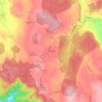
Name: Unterrehna topographic map, elevation, terrain.
Average elevation: 730 m
Minimum elevation: 564 m
Maximum elevation: 787 m
Other topographic maps
Click on a map to view its topography, its elevation and its terrain.
Oberhaslach
Deutschland > Baden-Württemberg > Bodenseekreis > Verwaltungsgemeinschaft Salem > Heiligenberg
Oberhaslach, Heiligenberg, Verwaltungsgemeinschaft Salem, Bodenseekreis, Baden-Württemberg, 88633, Deutschland
Average elevation: 722 m