
鞍山市 topographic map
Interactive map
Click on the map to display elevation.
About this map
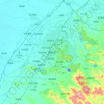
Name: 鞍山市 topographic map, elevation, terrain.
Location: 鞍山市, 胜利街道, 铁东区, 鞍山市, 辽宁省, 中国 (40.94752 122.83031 41.26752 123.15031)
Average elevation: 79 m
Minimum elevation: -53 m
Maximum elevation: 667 m