
Gatsibo District topographic map
Interactive map
Click on the map to display elevation.
About this map
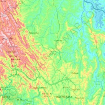
Name: Gatsibo District topographic map, elevation, terrain.
Location: Gatsibo District, East Province, Rwanda (-1.87657 30.16471 -1.45841 30.83988)
Average elevation: 1,540 m
Minimum elevation: 1,279 m
Maximum elevation: 2,278 m