
Presa del Llano topographic map
Interactive map
Click on the map to display elevation.
About this map
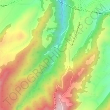
Name: Presa del Llano topographic map, elevation, terrain.
Location: Presa del Llano, Villa del Carbón, Estado de México, México (19.65490 -99.50944 19.65912 -99.50673)
Average elevation: 2,906 m
Minimum elevation: 2,740 m
Maximum elevation: 3,065 m
Other topographic maps
Click on a map to view its topography, its elevation and its terrain.
Presa "Taxhimay"
México > Estado de México > Villa del Carbón
Presa "Taxhimay", Villa del Carbón, Estado de México, México
Average elevation: 2,242 m