
Aixheim topographic map
Interactive map
Click on the map to display elevation.
About this map
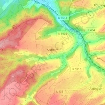
Name: Aixheim topographic map, elevation, terrain.
Average elevation: 655 m
Minimum elevation: 577 m
Maximum elevation: 716 m
Other topographic maps
Click on a map to view its topography, its elevation and its terrain.
Leipferdingen Bahnstation
Germany > Baden-Württemberg > Landkreis Tuttlingen > Geisingen > Leipferdingen
Average elevation: 750 m