
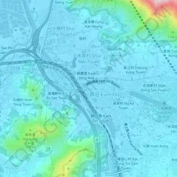
錦田市中心 topographic map
Interactive map
Click on the map to display elevation.
About this map
Name: 錦田市中心 topographic map, elevation, terrain.
Location: 錦田市中心, 錦田, 錦田市, 元朗區, 新界, 香港, 中国 (22.42047 114.04165 22.46047 114.08165)
Average elevation: 39 m
Minimum elevation: -5 m
Maximum elevation: 432 m
Other topographic maps
Click on a map to view its topography, its elevation and its terrain.