
Thank you for supporting this site ❤️
Make a donation
Make a donation
Freixo topographic map
Click on the map to display elevation.
Thank you for supporting this site ❤️
Make a donation
Make a donation
About this map
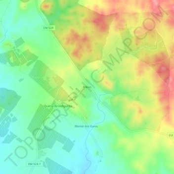
Name: Freixo topographic map, elevation, terrain.
Location: Freixo, Redondo, Évora, 7170-115, Portugal (38.66236 -7.67136 38.70236 -7.63136)
Average elevation: 278 m
Minimum elevation: 239 m
Maximum elevation: 331 m
Thank you for supporting this site ❤️
Make a donation
Make a donation
Other topographic maps
Click on a map to view its topography, its elevation and its terrain.