
Thank you for supporting this site ❤️
Make a donation
Make a donation
Westbrook topographic map
Click on the map to display elevation.
Thank you for supporting this site ❤️
Make a donation
Make a donation
About this map
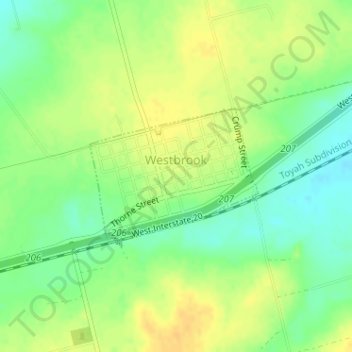
Name: Westbrook topographic map, elevation, terrain.
Location: Westbrook, Mitchell County, Texas, 79565, United States (32.35176 -101.02064 32.36214 -101.00532)
Average elevation: 657 m
Minimum elevation: 642 m
Maximum elevation: 669 m
Thank you for supporting this site ❤️
Make a donation
Make a donation
Other topographic maps
Click on a map to view its topography, its elevation and its terrain.