
Highland Heights topographic map
Interactive map
Click on the map to display elevation.
About this map
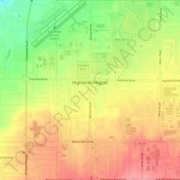
Name: Highland Heights topographic map, elevation, terrain.
Average elevation: 289 m
Minimum elevation: 233 m
Maximum elevation: 329 m
Other topographic maps
Click on a map to view its topography, its elevation and its terrain.
North Olmsted
États-Unis d'Amérique > Ohio > Cuyahoga County
North Olmsted, Cuyahoga County, Ohio, 44070, États-Unis d'Amérique
Average elevation: 229 m
Cleveland
États-Unis d'Amérique > Ohio > Cuyahoga County > Cleveland
Cleveland, Cuyahoga County, Ohio, 44114, États-Unis d'Amérique
Average elevation: 219 m
Brecksville
États-Unis d'Amérique > Ohio > Cuyahoga County
Brecksville, Cuyahoga County, Ohio, 44141, États-Unis d'Amérique
Average elevation: 292 m