
Thank you for supporting this site ❤️
Make a donation
Make a donation
Frankenholz topographic map
Click on the map to display elevation.
Thank you for supporting this site ❤️
Make a donation
Make a donation
Frankenholz
Frankenholz ist ein Stadtteil von Bexbach im Saarland. Der Ort liegt am Südhang des Höcherberges auf etwa 300–450 Meter Meereshöhe. Die Fläche des Ortes beträgt 202 ha.
Thank you for supporting this site ❤️
Make a donation
Make a donation
About this map
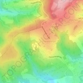
Name: Frankenholz topographic map, elevation, terrain.
Location: Frankenholz, Bexbach, Saarpfalz-Kreis, Saarland, Deutschland (49.37309 7.24020 49.38990 7.26632)
Average elevation: 380 m
Minimum elevation: 270 m
Maximum elevation: 500 m
Thank you for supporting this site ❤️
Make a donation
Make a donation
Other topographic maps
Click on a map to view its topography, its elevation and its terrain.