
Bunga topographic map
Click on the map to display elevation.
About this map
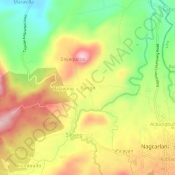
Name: Bunga topographic map, elevation, terrain.
Location: Bunga, Nagcarlan, Laguna, Calabarzon, 4002, Philippines (14.13000 121.37701 14.17000 121.41701)
Average elevation: 169 m
Minimum elevation: 42 m
Maximum elevation: 295 m
Other topographic maps
Click on a map to view its topography, its elevation and its terrain.
Mounts Banahaw–San Cristobal Protected Landscape
Philippines > Laguna > Nagcarlan
Average elevation: 707 m