
Dondaicha topographic map
Interactive map
Click on the map to display elevation.
About this map
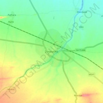
Name: Dondaicha topographic map, elevation, terrain.
Location: Dondaicha, Sindkhede, Dhule, Maharashtra, 425408, India (21.28562 74.52120 21.36562 74.60120)
Average elevation: 167 m
Minimum elevation: 134 m
Maximum elevation: 218 m
Other topographic maps
Click on a map to view its topography, its elevation and its terrain.
Vikhurle
India > Maharashtra > Sindkhede
Vikhurle, Sindkhede, Dhule, Maharashtra, 425408, India
Average elevation: 164 m