
Thank you for supporting this site ❤️
Make a donation
Make a donation
Soras topographic map
Click on the map to display elevation.
Thank you for supporting this site ❤️
Make a donation
Make a donation
About this map
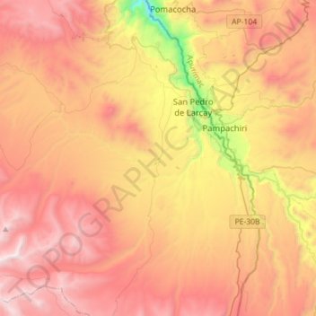
Name: Soras topographic map, elevation, terrain.
Location: Soras, Province of Sucre, Ayacucho, Peru (-14.35073 -73.82312 -14.07652 -73.57773)
Average elevation: 3,902 m
Minimum elevation: 2,723 m
Maximum elevation: 4,793 m
Thank you for supporting this site ❤️
Make a donation
Make a donation
Other topographic maps
Click on a map to view its topography, its elevation and its terrain.
Thank you for supporting this site ❤️
Make a donation
Make a donation
Thank you for supporting this site ❤️
Make a donation
Make a donation
Thank you for supporting this site ❤️
Make a donation
Make a donation