
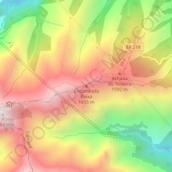
Encumeada Baixa topographic map
Interactive map
Click on the map to display elevation.
About this map
Name: Encumeada Baixa topographic map, elevation, terrain.
Location: Encumeada Baixa, Santana, Madeira, 9230-209, Portugal (32.76327 -16.92716 32.76337 -16.92706)
Average elevation: 1,334 m
Minimum elevation: 730 m
Maximum elevation: 1,834 m
Other topographic maps
Click on a map to view its topography, its elevation and its terrain.