
Chausse topographic map
Interactive map
Click on the map to display elevation.
About this map
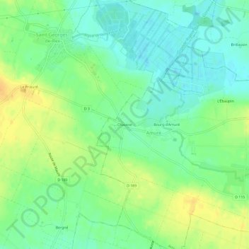
Name: Chausse topographic map, elevation, terrain.
Average elevation: 13 m
Minimum elevation: 0 m
Maximum elevation: 29 m
Other topographic maps
Click on a map to view its topography, its elevation and its terrain.
Bourg d'Amuré
France > Nouvelle-Aquitaine > Deux-Sèvres > Amuré
Bourg d'Amuré, Amuré, Niort, Deux-Sèvres, Nouvelle-Aquitaine, France métropolitaine, 79210, France
Average elevation: 13 m
L'Ébaupin
France > Nouvelle-Aquitaine > Deux-Sèvres > Amuré > L'Ébaupin
L'Ébaupin, Amuré, Niort, Deux-Sèvres, Nouvelle-Aquitaine, France métropolitaine, 79210, France
Average elevation: 13 m