
西岸 topographic map
Interactive map
Click on the map to display elevation.
About this map
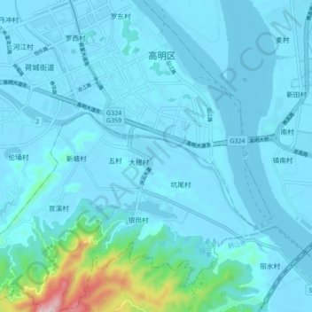
Name: 西岸 topographic map, elevation, terrain.
Location: 西岸, 佛山市, 广东省, 528500, 中国 (22.83729 112.84504 22.91729 112.92504)
Average elevation: 43 m
Minimum elevation: -3 m
Maximum elevation: 517 m