
Sussex topographic map
Interactive map
Click on the map to display elevation.
About this map
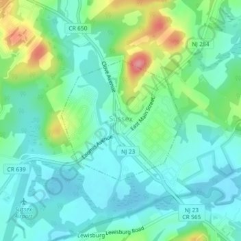
Name: Sussex topographic map, elevation, terrain.
Location: Sussex, Sussex County, New Jersey, 10985, United States (41.20284 -74.61655 41.21633 -74.59857)
Average elevation: 142 m
Minimum elevation: 116 m
Maximum elevation: 215 m
Due to its inland location and elevation, Sussex has a climate much cooler than most of the state, classified as humid continental (Köppen Dfa), with cold, moderately snowy winters, and very warm, humid summers. It is part of USDA Plant Hardiness Zone 6. The monthly daily average temperature ranges from 25.8 °F (−3.4 °C) in January to 71.8 °F (22.1 °C) in July. Temperatures reach 90 °F (32 °C) on 13.4 days and fall to 0 °F (−18 °C) on 5.2 nights annually. Snowfall averages 38.7 inches (98 cm) per season, although this usually varies widely from year to year. Extremes in the temperature range from −29 °F (−34 °C) on January 21, 1994 up to 106 °F (41 °C) on July 10, 1936.