
Graeagle topographic map
Click on the map to display elevation.
About this map
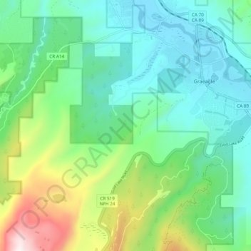
Name: Graeagle topographic map, elevation, terrain.
Location: Graeagle, Plumas County, California, 96103, United States (39.72314 -120.69258 39.78349 -120.59754)
Average elevation: 1,574 m
Minimum elevation: 1,318 m
Maximum elevation: 2,292 m
Other topographic maps
Click on a map to view its topography, its elevation and its terrain.