
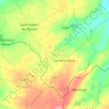
La Commanderie topographic map
Interactive map
Click on the map to display elevation.
About this map
Name: La Commanderie topographic map, elevation, terrain.
Average elevation: 77 m
Minimum elevation: 21 m
Maximum elevation: 135 m
Other topographic maps
Click on a map to view its topography, its elevation and its terrain.
La Troudière
France > Normandie > Manche > Saint-Sauveur-Villages > Le Mesnilbus > La Troudière
La Troudière, Le Mesnilbus, Saint-Sauveur-Villages, Coutances, Manche, Normandie, France métropolitaine, 50490, France
Average elevation: 70 m
La Patinière
France > Normandie > Manche > Saint-Sauveur-Villages > Le Mesnilbus
La Patinière, Le Mesnilbus, Saint-Sauveur-Villages, Coutances, Manche, Normandie, France métropolitaine, 50490, France
Average elevation: 77 m