
Mechtat Ayad topographic map
Interactive map
Click on the map to display elevation.
About this map
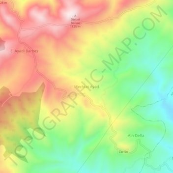
Name: Mechtat Ayad topographic map, elevation, terrain.
Average elevation: 824 m
Minimum elevation: 553 m
Maximum elevation: 1,116 m
Other topographic maps
Click on a map to view its topography, its elevation and its terrain.
Kherba
Algérie > Mila > Daïra Aïn Beida Harriche > Aïn Beida Harriche
Kherba, Aïn Beida Harriche, Daïra Aïn Beida Harriche, Mila, Algérie
Average elevation: 615 m