
Thank you for supporting this site ❤️
Make a donation
Make a donation
Loretello topographic map
Click on the map to display elevation.
Thank you for supporting this site ❤️
Make a donation
Make a donation
About this map
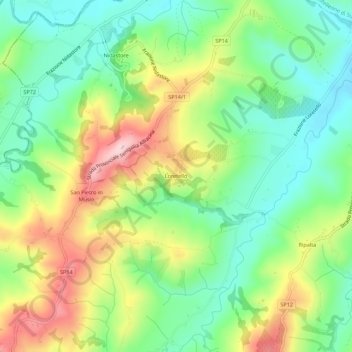
Name: Loretello topographic map, elevation, terrain.
Location: Loretello, Arcevia, Ancona, Marche, 60011, Italia (43.54928 12.92462 43.58928 12.96462)
Average elevation: 238 m
Minimum elevation: 148 m
Maximum elevation: 380 m
Thank you for supporting this site ❤️
Make a donation
Make a donation