
Stavelot topographic map
Interactive map
Click on the map to display elevation.
About this map
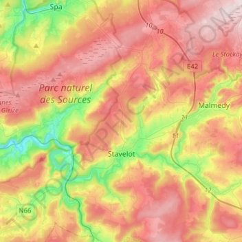
Name: Stavelot topographic map, elevation, terrain.
Location: Stavelot, Verviers, Lieja, Valonia, 4970, Bélgica (50.33550 5.85104 50.49632 6.03048)
Average elevation: 431 m
Minimum elevation: 198 m
Maximum elevation: 639 m