
尼木县 topographic map
Interactive map
Click on the map to display elevation.
About this map
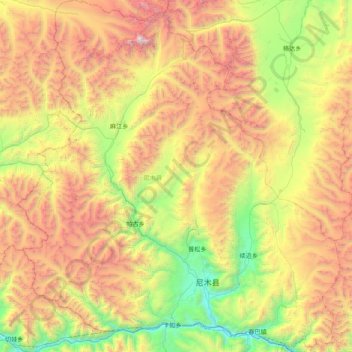
Name: 尼木县 topographic map, elevation, terrain.
Location: 尼木县, 拉萨市, 西藏自治区, 中国 (29.29876 89.75281 29.97962 90.46870)
Average elevation: 4,989 m
Minimum elevation: 3,676 m
Maximum elevation: 6,962 m
Other topographic maps
Click on a map to view its topography, its elevation and its terrain.