
Thank you for supporting this site ❤️
Make a donation
Make a donation
Amang topographic map
Click on the map to display elevation.
Thank you for supporting this site ❤️
Make a donation
Make a donation
About this map
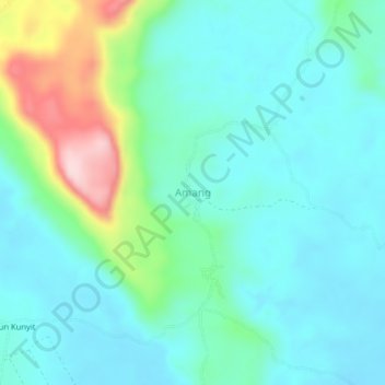
Name: Amang topographic map, elevation, terrain.
Location: Amang, Ngabang, Landak, West Kalimantan, Kalimantan, Indonesia (0.50501 109.80036 0.54501 109.84036)
Average elevation: 93 m
Minimum elevation: 32 m
Maximum elevation: 308 m
Thank you for supporting this site ❤️
Make a donation
Make a donation