
Thank you for supporting this site ❤️
Make a donation
Make a donation
Las Matas topographic map
Click on the map to display elevation.
Thank you for supporting this site ❤️
Make a donation
Make a donation
About this map
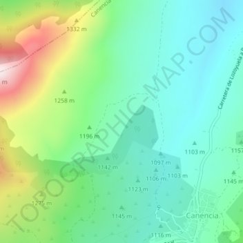
Name: Las Matas topographic map, elevation, terrain.
Location: Las Matas, Canencia, Sierra Norte, Comunidad de Madrid, España (40.90995 -3.75936 40.92995 -3.73936)
Average elevation: 1,187 m
Minimum elevation: 1,049 m
Maximum elevation: 1,532 m
Thank you for supporting this site ❤️
Make a donation
Make a donation