
Altenbach topographic map
Interactive map
Click on the map to display elevation.
About this map
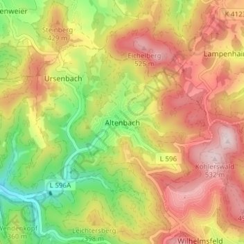
Name: Altenbach topographic map, elevation, terrain.
Average elevation: 374 m
Minimum elevation: 196 m
Maximum elevation: 534 m
Other topographic maps
Click on a map to view its topography, its elevation and its terrain.
Ursenbach
Deutschland > Baden-Württemberg > Rhein-Neckar-Kreis > Schriesheim
Ursenbach, Schriesheim, Rhein-Neckar-Kreis, Baden-Württemberg, 69517, Deutschland
Average elevation: 331 m