
Goihenetxea topographic map
Interactive map
Click on the map to display elevation.
About this map
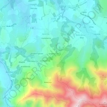
Name: Goihenetxea topographic map, elevation, terrain.
Average elevation: 335 m
Minimum elevation: 183 m
Maximum elevation: 751 m
Other topographic maps
Click on a map to view its topography, its elevation and its terrain.
Etxeberrigaraia
France > Nouvelle-Aquitaine > Pyrénées-Atlantiques > Aincille
Etxeberrigaraia, Aincille, Bayonne, Pyrénées-Atlantiques, Nouvelle-Aquitaine, France métropolitaine, 64220, France
Average elevation: 317 m
Xiranberroa
France > Nouvelle-Aquitaine > Pyrénées-Atlantiques > Aincille
Xiranberroa, Aincille, Bayonne, Pyrénées-Atlantiques, Nouvelle-Aquitaine, France métropolitaine, 64220, France
Average elevation: 331 m