
Thank you for supporting this site ❤️
Make a donation
Make a donation
Longsart topographic map
Click on the map to display elevation.
Thank you for supporting this site ❤️
Make a donation
Make a donation
About this map
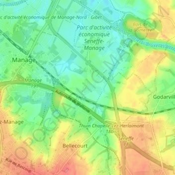
Name: Longsart topographic map, elevation, terrain.
Location: Longsart, Manage, Soignies, Hainaut, Wallonie, 7170, Belgique (50.47764 4.23860 50.51764 4.27860)
Average elevation: 140 m
Minimum elevation: 113 m
Maximum elevation: 178 m
Thank you for supporting this site ❤️
Make a donation
Make a donation
Other topographic maps
Click on a map to view its topography, its elevation and its terrain.