
Santa Rosa de Flandes topographic map
Interactive map
Click on the map to display elevation.
About this map
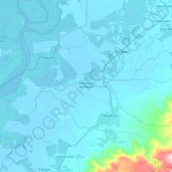
Name: Santa Rosa de Flandes topographic map, elevation, terrain.
Location: Santa Rosa de Flandes, Naranjal, Guayas, Ecuador (-2.71037 -79.79438 -2.56609 -79.58170)
Average elevation: 49 m
Minimum elevation: -4 m
Maximum elevation: 827 m
Other topographic maps
Click on a map to view its topography, its elevation and its terrain.
Reserva Ecológica Manglares Churute
Reserva Ecológica Manglares Churute, Taura, Naranjal, Guayas, 091205, Ecuador
Average elevation: 13 m