
Thank you for supporting this site ❤️
Make a donation
Make a donation
Grafenberg topographic map
Click on the map to display elevation.
Thank you for supporting this site ❤️
Make a donation
Make a donation
About this map
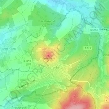
Name: Grafenberg topographic map, elevation, terrain.
Average elevation: 379 m
Minimum elevation: 326 m
Maximum elevation: 476 m
Thank you for supporting this site ❤️
Make a donation
Make a donation
Other topographic maps
Click on a map to view its topography, its elevation and its terrain.
Ableitung Erms
Germany > Baden-Württemberg > Landkreis Reutlingen > Dettingen an der Erms
Average elevation: 482 m
Thank you for supporting this site ❤️
Make a donation
Make a donation
Untergreifenstein
Germany > Baden-Württemberg > Landkreis Reutlingen > Lichtenstein
Average elevation: 661 m
Thank you for supporting this site ❤️
Make a donation
Make a donation