
Glen topographic map
Interactive map
Click on the map to display elevation.
About this map
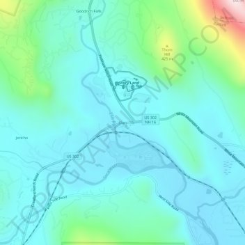
Name: Glen topographic map, elevation, terrain.
Average elevation: 240 m
Minimum elevation: 150 m
Maximum elevation: 668 m
Other topographic maps
Click on a map to view its topography, its elevation and its terrain.
Big Attitash Mountain
United States > New Hampshire > Carroll County > Bartlett
Big Attitash Mountain, Bartlett, Carroll County, New Hampshire, United States
Average elevation: 711 m
Thorn Hill
United States > New Hampshire > Carroll County > Bartlett
Thorn Hill, Bartlett, Carroll County, New Hampshire, 03838, United States
Average elevation: 311 m