
La Piègerie topographic map
Interactive map
Click on the map to display elevation.
About this map
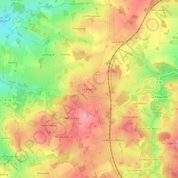
Name: La Piègerie topographic map, elevation, terrain.
Average elevation: 349 m
Minimum elevation: 274 m
Maximum elevation: 404 m
Other topographic maps
Click on a map to view its topography, its elevation and its terrain.
Beautribeau
France > Nouvelle-Aquitaine > Creuse > Saint-Agnant-de-Versillat
Beautribeau, Saint-Agnant-de-Versillat, Guéret, Creuse, Nouvelle-Aquitaine, France métropolitaine, 23300, France
Average elevation: 347 m