
Hufen topographic map
Interactive map
Click on the map to display elevation.
About this map
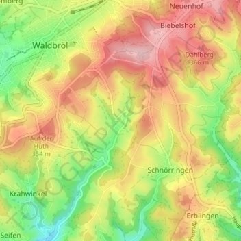
Name: Hufen topographic map, elevation, terrain.
Average elevation: 308 m
Minimum elevation: 216 m
Maximum elevation: 393 m
Other topographic maps
Click on a map to view its topography, its elevation and its terrain.
Heide
Deutschland > Nordrhein-Westfalen > Oberbergischer Kreis > Waldbröl > Schnörringen
Heide, Schnörringen, Waldbröl, Oberbergischer Kreis, Nordrhein-Westfalen, 51545, Deutschland
Average elevation: 315 m