
Eaton Park topographic map
Interactive map
Click on the map to display elevation.
About this map
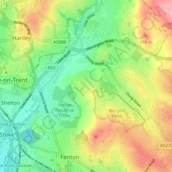
Name: Eaton Park topographic map, elevation, terrain.
Location: Eaton Park, Stoke-on-Trent, England, ST2 9ND, United Kingdom (52.99472 -2.17036 53.03472 -2.13036)
Average elevation: 152 m
Minimum elevation: 101 m
Maximum elevation: 222 m
Other topographic maps
Click on a map to view its topography, its elevation and its terrain.
Hanley
United Kingdom > England > Stoke-on-Trent
Hanley, Stoke-on-Trent, England, ST1 1LD, United Kingdom
Average elevation: 154 m
Stoke-on-Trent
United Kingdom > England > Stoke-on-Trent
Stoke-on-Trent, West Midlands, England, ST1 4NP, United Kingdom
Average elevation: 160 m