
Thank you for supporting this site ❤️
Make a donation
Make a donation
Toledo topographic map
Click on the map to display elevation.
Thank you for supporting this site ❤️
Make a donation
Make a donation
About this map
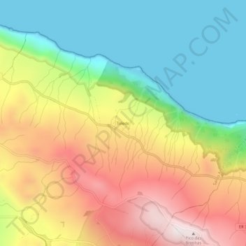
Name: Toledo topographic map, elevation, terrain.
Location: Toledo, Santo Amaro, Velas, Açores, 9800-338, Portugal (38.67693 -28.16749 38.71693 -28.12749)
Average elevation: 374 m
Minimum elevation: 0 m
Maximum elevation: 882 m
Thank you for supporting this site ❤️
Make a donation
Make a donation