
Thank you for supporting this site ❤️
Make a donation
Make a donation
Volta do Vale topographic map
Click on the map to display elevation.
Thank you for supporting this site ❤️
Make a donation
Make a donation
About this map
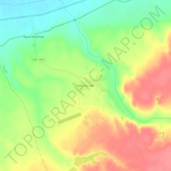
Name: Volta do Vale topographic map, elevation, terrain.
Location: Volta do Vale, Couço, Coruche, Santarém, Portugal (38.95187 -8.41048 38.99187 -8.37048)
Average elevation: 56 m
Minimum elevation: 19 m
Maximum elevation: 91 m
Thank you for supporting this site ❤️
Make a donation
Make a donation
Other topographic maps
Click on a map to view its topography, its elevation and its terrain.