
岗色乡 topographic map
Interactive map
Click on the map to display elevation.
About this map
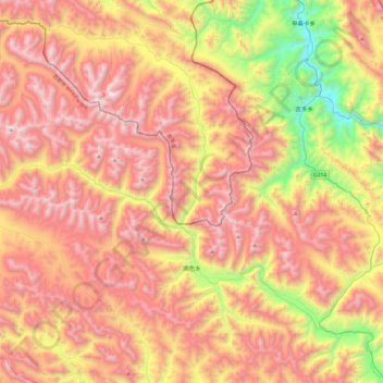
Name: 岗色乡 topographic map, elevation, terrain.
Location: 岗色乡, 类乌齐县, 昌都市, 西藏自治区, 中国 (31.45300 95.82436 31.82308 96.30774)
Average elevation: 4,608 m
Minimum elevation: 3,612 m
Maximum elevation: 5,436 m
Other topographic maps
Click on a map to view its topography, its elevation and its terrain.