
Carnikavas pagasts topographic map
Interactive map
Click on the map to display elevation.
About this map
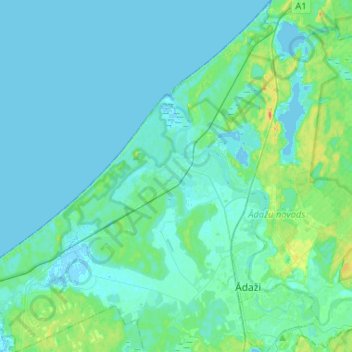
Name: Carnikavas pagasts topographic map, elevation, terrain.
Location: Carnikavas pagasts, Ādažu novads, Lijfland, LV-2163, Letland (57.05562 24.11696 57.19706 24.34767)
Average elevation: 5 m
Minimum elevation: -3 m
Maximum elevation: 32 m