
Thank you for supporting this site ❤️
Make a donation
Make a donation
Honnelles topographic map
Click on the map to display elevation.
Thank you for supporting this site ❤️
Make a donation
Make a donation
About this map
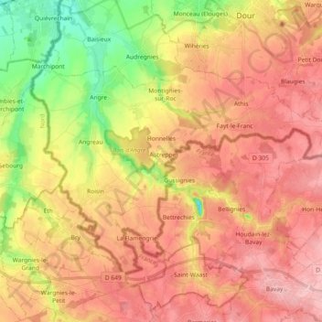
Name: Honnelles topographic map, elevation, terrain.
Location: Honnelles, Bergen, Henegouwen, Wallonië, 7387, België (50.30316 3.65716 50.38458 3.83899)
Average elevation: 100 m
Minimum elevation: 16 m
Maximum elevation: 158 m
Thank you for supporting this site ❤️
Make a donation
Make a donation
Other topographic maps
Click on a map to view its topography, its elevation and its terrain.
Thank you for supporting this site ❤️
Make a donation
Make a donation
Thank you for supporting this site ❤️
Make a donation
Make a donation
Sirault
België > Henegouwen > Bergen > Saint-Ghislain
De hoogte aan de kerk bedraagt 67 meter.
Average elevation: 74 m
Thank you for supporting this site ❤️
Make a donation
Make a donation
Thank you for supporting this site ❤️
Make a donation
Make a donation