
Le Paire topographic map
Interactive map
Click on the map to display elevation.
About this map
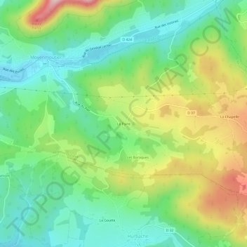
Name: Le Paire topographic map, elevation, terrain.
Average elevation: 403 m
Minimum elevation: 306 m
Maximum elevation: 575 m
Other topographic maps
Click on a map to view its topography, its elevation and its terrain.
Saint-Prayel
France > Grand Est > Vosges > Moyenmoutier
Saint-Prayel, Moyenmoutier, Saint-Dié-des-Vosges, Vosges, Grand Est, France métropolitaine, 88420, France
Average elevation: 402 m