
Aussichtsturm Hohenbodman topographic map
Interactive map
Click on the map to display elevation.
About this map
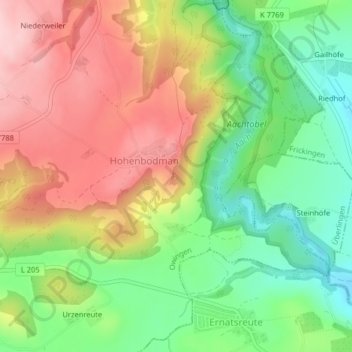
Name: Aussichtsturm Hohenbodman topographic map, elevation, terrain.
Average elevation: 578 m
Minimum elevation: 475 m
Maximum elevation: 693 m
Other topographic maps
Click on a map to view its topography, its elevation and its terrain.
Hohenbodman
Deutschland > Baden-Württemberg > Bodenseekreis > Hohenbodman
Hohenbodman, Owingen, Verwaltungsgemeinschaft Überlingen, Bodenseekreis, Baden-Württemberg, 88696, Deutschland
Average elevation: 584 m